


Having heard a lot about the use of geo-locations and satellite imagery in the investigative sector, I wanted to try my hands on it. It is startling to know that from us amateurs to expert journalists, the resources that we use for it are almost the same.
Google Earth, Wikimapia, Planet and Google Maps are some of the platforms used by everyone to study images taken with geo satellites. When it comes to before/after pictures or pictures from certain times and not the present, google earth is the best option. Eliot Higgins, founder of the Brown Moses Blog and Bellingcat, both platforms being important publishing platforms on investigations on warfare, also advises his fellows to use these same tools. In his article on how he uses satellite imagery to investigate, Higgins was addressing an amateur audience. I, similarly, will focus on amateur audience only, though I too am one.
My first experience with such tools was very recent, the bombing of a funeral in the capital of Yemen, Sana’a. If I go into what actually happened at the funeral, and the how, who, and why of the bombings, it will be unnecessary here. I’ll rather talk about the small investigation that I did.
Geolocating exactly where the bombing happened was not a very tedious task, but, patience is definitely required to work on places that are not very popular. News reports on the bombing mentioned this street called the 50th street, which I easily reached typing it on google maps. Also, the name of the place was mentioned as Al-Kobra Grand Hall. The problem comes when maps are marked in other languages than your native one. The map of Yemen, was of course, marked in Arabic. All that I did after reaching 50th street, was to spend 15 minutes following the street on both sides until I finally realised that is not necessary that the hall would be adjacent to the main street. I spent another 10 minutes looking at places adjacent to the branches of the main street, to finally find the place I had been looking for, though it was named in Arabic.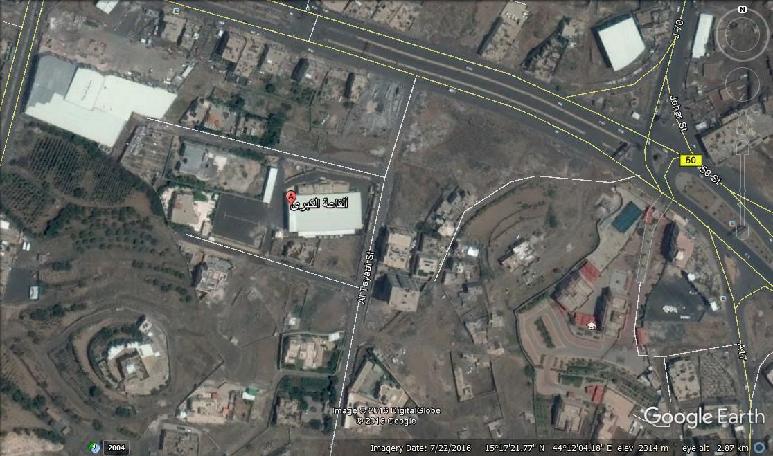
Now, when you look at the place, it is clearly a residential area, which is another allegation on the bombers (Saudi Arabia), bombing and killing civilians— which is, and should be counted as a war crime.
To verify my imagery, I compared it to the snapshots that I took from videos posted by witnesses. Expected, this was the result:
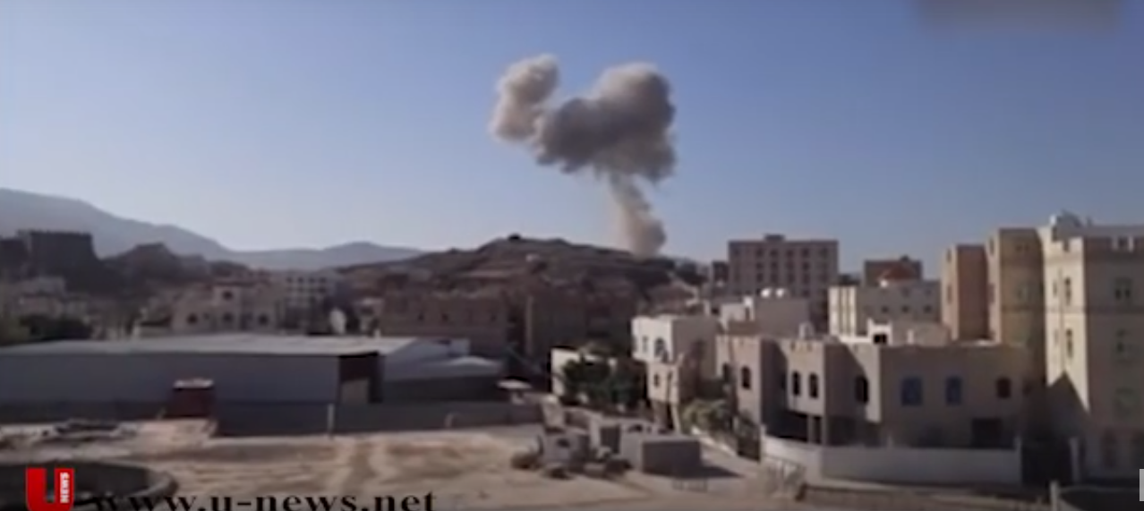
I decided to locate the place the video has been taken from, on google earth. Now the camera man appears to be much higher than the ground level, which implies that he/she could be standing on a 3-4 storey building similar to what can be seen in the picture. Also, notice this rectangular building in the forefront, and the hills visible in the background, locations and landmarks like these should always be kept in mind, because they help a lot.
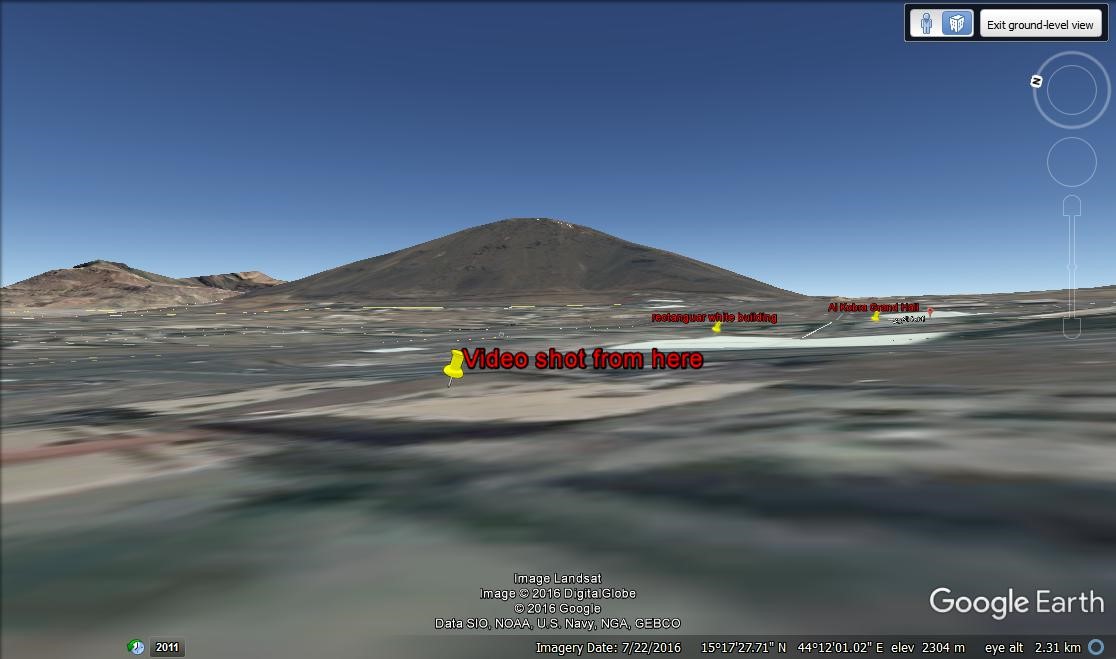
Finally, I was able to locate the same scene with ‘street level’ option on Google Earth. This street level comes as an important tool because it shows you the terrain of the location. So if there’s a mountain somewhere, the elevation will be visible in the street view.
Compare the previous picture to this screenie taken on google earth. Through the landmark tool, I have marked where the rectangular white building is, where Al Kobra Grand Hall is, and where the video was shot from. It is now verified where exactly the bombing took place and also, where the video was recorded from.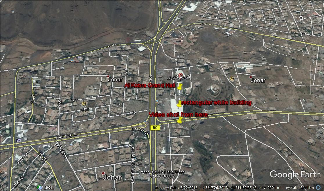
In this fast pacing era of technology, where anyone and everyone can be a journalist, tools like these come in handy. It has become very easy for everyone to investigate themselves into matters, when one doesn’t find any credible sources.

 for India")
